
Anthropology, representation and AI
Africa at scale
The United Nations backs correcting a centuries-old cartographic distortion. Three weeks later, Accra is debating another form of representation of the continent: the one being encoded into artificial intelligence systems.
Africa covers around 30.3 million square kilometres. Greenland, around 2.2 million. The African continent is therefore roughly fourteen times larger.
Yet on many of the world maps through which several generations learnt geography, the two landmasses appear to occupy comparable areas.
The problem is not that someone deliberately drew Africa smaller. Gerardus Mercator developed his projection in 1569 to solve a specific navigational problem. It preserves local angles and directions, a property particularly useful for navigation, but progressively distorts surface areas as we move away from the equator. [1][2]
Greenland grows. Europe grows. Africa and much of the equatorial belt appear to shrink.
A technical solution built for a specific function ended up becoming one of the ordinary images of the world.
And it does not belong only to school atlases. A variant, EPSG:3857 (Web Mercator), remains a reference system widely used to display maps in digital services such as Google Maps, OpenStreetMap, Bing and ArcGIS. [1]
The distortion therefore has a long history and a contemporary life.
On 4 September, the United Nations General Assembly adopted, on a non-binding basis, resolution A/80/L.104, Correct the Map: Rebalancing Global Cartographic Representation and Promoting Equitable Representation of the World’s Regions, Particularly Africa. It received 164 votes in favour, one against and six abstentions. The proposal was introduced by Togo on behalf of the African Group and backed by the African Union. [3][4][5]
The resolution does not ban Mercator or establish a single compulsory world map. It encourages governments, educational institutions, international organisations and technology companies to use equal-area projections when accurate comparisons of the relative surface area of countries and continents matter, and to explain the limitations inherent in representing a sphere on a flat surface. [3][4]
The Correct the Map campaign, launched by Africa No Filter and Speak Up Africa and later backed by the African Union, has used Equal Earth as one of its principal alternatives. The projection was developed in 2018 by Bojan Šavrič, Tom Patterson and Bernhard Jenny to preserve relative areas while retaining a recognisable image of the world. [2][6]
The image matters precisely because it appears innocent.
A map does not contain the territory. It represents it.
To do so, it selects certain properties and sacrifices others. No flat projection can preserve area, shape, distance and direction simultaneously without distortion.
The problem emerges when we stop perceiving that selection and a particular representation begins to be confused with the world itself.
The United Nations debate made clear that this discussion is not free of political conflict either.
The United States cast the only vote against. Its delegation rejected the broader political framing of the initiative and objected to concepts such as “cognitive justice” and “memorial reparation”. Togo, by contrast, presented the cartographic problem precisely in terms of knowledge, historical memory, dignity and collective perception. [4][5]
Ukraine and Serbia, which abstained, shared the objective of accurately representing continental surface areas but raised objections to particular maps associated with Equal Earth and the depiction of disputed territories. As the European Union clarified in the chamber, the resolution concerns only the relative size of continental landmasses and does not alter borders, sovereignty or territorial status. [4]
The dispute helps us understand something important.
Even when we know mathematically the surface area of a territory, representing it remains a political and cultural operation.
During the debate, the Togolese delegation used a particularly suggestive expression: “cognitive justice”. The resolution links it to the way representations repeated over generations can influence how people imagine the world. [3][4]
This is where cartography approaches a classic concern of anthropology.
Categories, classifications and devices of representation do not merely describe pre-existing realities. They also participate in the ways those realities become visible, comparable and thinkable.
Mahmoud Ali Youssouf, Chairperson of the African Union Commission, returned to this dimension on 9 September, on African Union Day. He presented correcting the map as part of a broader question about the continent’s capacity to define its own position and future. Africa’s progress, he argued, should not be measured only by how it is represented from outside, but also by its capacity to build an integrated, strong continent able to shape its own destiny. [7]
Three weeks after the vote, that question reappears in another kind of infrastructure.
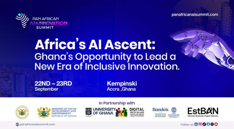
On 22 and 23 September, Accra hosts the second Pan African AI & Innovation Summit. The event brings together public administrations, academia, companies, technology communities and entrepreneurial ecosystems from more than forty African countries and the diaspora. Its organisers place public policy, skills, partnerships and capacity-building at the centre of the programme. [8][9]
But some details are even more significant.
The summit’s wider ecosystem describes a path “from indigenous language models to sovereign data infrastructure”. Its programme and promotional material also foreground sovereign digital architecture, models developed from African contexts and locally built natural-language-processing solutions. [8][10]
The connection with the map therefore ceases to be merely metaphorical.
Mercator and an artificial intelligence model are radically different technologies, separated by centuries of history.
They nevertheless share an elementary condition.
Neither reproduces the world. Both represent it.
A model selects too. It learns from some corpora and not others. Some languages are documented on a massive scale; others have much smaller bodies of accessible digital material. Available data come from institutions and societies with profoundly unequal capacities to publish, store and circulate knowledge.
What a system can recognise also depends on what it was able to find.
That is why concepts such as indigenous models, Afrocentric data or sovereign data infrastructure matter more than another demonstration of an AI application.
They change the subject of the sentence.
For decades, much international technology discourse has spoken of bringing connectivity, digitisation or artificial intelligence to Africa.
That construction can easily place the continent at the destination end of technologies conceived, financed and trained elsewhere.
Speaking from Accra about building models, governing data and developing local infrastructure introduces another possible direction.
Africa ceases to appear only as a place where technology is to be deployed. It also becomes one of the places from which it can be debated what data are needed, which languages should be represented, which problems deserve attention and which institutions should be able to audit the systems.
The path taken by Correct the Map is revealing for a similar reason.
The campaign began with African organisations challenging a global representation so ordinary that it had ceased to seem debatable. The African Union Assembly later backed the initiative, and Togo carried the proposal, on behalf of the African Group, to the United Nations. [5][6][11]
The direction matters.
It was not an external institution that identified a problematic representation and decided to correct it for Africa.
The demand travelled from Africa towards the institutions responsible for representing the world.
Accra now poses related questions in a much newer infrastructure.
Who builds the systems that describe Africa. Which languages they encounter. Which archives they know. Who establishes their categories. Who has the data and computing capacity to modify them. Who can check their outputs and who remains merely a user of models designed elsewhere.
Correcting a cartographic projection does not correct the economic, political or technological relations that have historically shaped how the continent is represented.
Equal Earth is not a perfect map either. No projection can be.
But it forces a relatively uncommon operation.
To look again at something that had come to seem natural.
In Mercator, Africa could appear reduced without many of us who used the map noticing the distortion.
Algorithmic infrastructures can acquire a similar invisibility when their corpora, categories and classifications become sufficiently embedded in everyday life.
That is why this week dedicated to Africa can begin here.
Not only by asking how the world sees the continent, but who has the instruments with which to represent it.
Changing the map also means contesting who has the capacity to draw it.
References
[1] EPSG. WGS 84 / Pseudo-Mercator — EPSG:3857 (Web Mercator). https://epsg.io/3857
[2] Equal Earth. The Equal Earth map projection. https://equal-earth.com/
[3] United Nations General Assembly. A/80/L.104 — “Correct the map”: Rebalancing global cartographic representation and promoting equitable representation of the world’s regions, particularly Africa. https://docs.un.org/A/80/L.104
[4] United Nations General Assembly. A/80/PV.114 — 114th plenary meeting, 80th session. 4 September 2026. https://docs.un.org/A/80/PV.114
[5] United Nations, Office of the Special Adviser on Africa. Victory for Africa as UN Votes on Resolution to “Correct the Map”. 8 September 2026. https://www.un.org/osaa/en/news/victory-africa-un-votes-resolution-correct-map
[6] Correct the Map. Africa No Filter / Speak Up Africa. https://correctthemap.org/
[7] African Union. Statement of the Chairperson of the African Union Commission on the Occasion of African Union Day. 9 September 2026. https://www.au.int/en/node/46918
[8] Pan African AI & Innovation Summit. PAAIS 2026. Accra, 22–23 September 2026. https://panafricanaisummit.com/
[9] Ghana News Agency. PAAIS 2026 to champion digital skills, innovation. 24 January 2026. https://gna.org.gh/2026/01/paais-2026-to-champion-digital-skills-innovation/
[10] Ghana AI Summit. Opportunities Showcase — Pan African AI & Innovation Summit. https://ghanaaisummit.com/directory_infos?info_type=opportunity
[11] African Union. AU leaders adopt historic initiative to Correct the Map of Africa, advancing implementation and global repositioning of the Continent. 12 June 2026. https://au.int/en/node/46520